Services
- Home
- Services
What We Offer
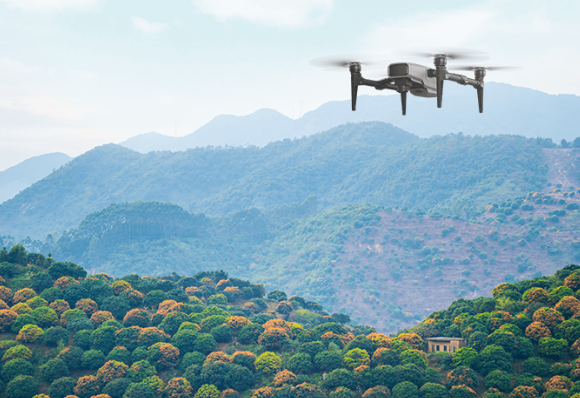
Our Expertise: Comprehensive Agricultural Solutions
Use our advanced agricultural drone technologies and solutions to manage your whole farm easily. We make it easy for you to access agricultural intelligence solutions.
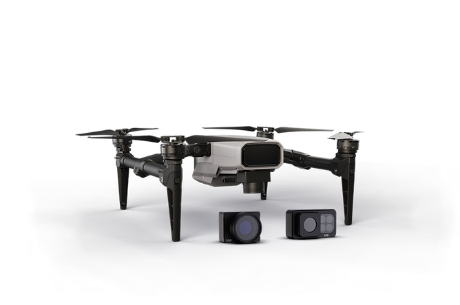
XMission Works for 3D Mapping, Effortless
- Parameter pre-setting on smartphone.
- Centimetre-level mapping, terrain-adaptive.
- Support RGB and multi-spectrum camera.
Digital Field
- XStation for on-site processing, quick & offline.
- Encrypted cloud computing, high-speed & large-scale.
- Generating HD Ortho Map and 3D Model.
AI Cloud/Edge Recognition, All Happen in Seconds
- Identify field boundaries and obstacles.
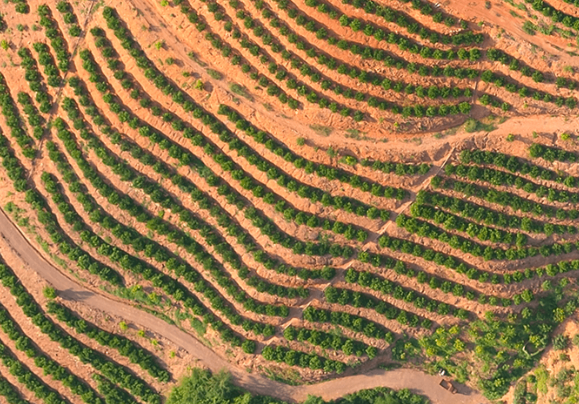
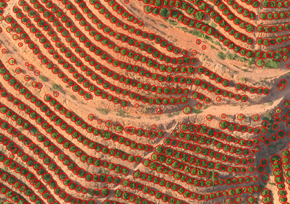
- Fruit tree locating, specific into centre and perimeter.
- Identify weed/pest disease.
- Identify cotton boll opening rate.
XPlanet Autonomous Operation, Precision with Ease
- Large-scale, discriminating operation.
- AI Prescription Map of Variable-rate Application.
What surveying & mapping drone can do?
SURVEYING & MAPPING DRONE
This solution gives farmers the best surveying drone to survey their fields in real time and with intelligent and accurate data.
Farmers can use it to estimate future productivity, optimise inputs, and react quickly to any dangers.
TERRAIN ANALYSIS
Allows the mapping flight to continue with the drone tracking the terrain.
NDVI MAPPING
Healthy vegetation can be identified using Normalized Difference Vegetation Index (NDVI).
3D MAPPING
Clear 3D modelling with accurate dimension for your farm.
FIELD MAPPING
More accurate the area of farmers' land.
IRRIGATION/ PIPING PLANNING
Plan irrigation or piping system at your farm with our data.
Site Spesific Nutrient Management
Accurate land nutrient identification for your farm.
WHAT DRONE SURVEYING CAN DO?
DRONE SURVEYING
This solution gives farmers the best surveying drone to survey their fields in real time and with intelligent and accurate data.
Farmers can use it to estimate future productivity, optimise inputs, and react quickly to any dangers.
Benefit of drone surveying & mapping

Boundary Check
- Create geo-referenced orthomosaics, elevation models or 3D models of the farm area.
- These maps can also be used to extract information such as highly- accurate distances for the plantation boundary check.

Plantation Land Usage Analysis
- Digital Elevation Modelling (DEM) for creating height and depth data of land.
- Surveying for output prediction.

MULTISPECTRAL IMAGERY
- Normalized difference vegetation index (NDVI) and Normalized difference red-edge index (NDRE) analysis.
- Precise and efficient vegetation growth monitoring.

TREE COUNTING
- By counting number of plants in the farm, the land owner can precisely understand the land usage.
- By understanding the land usage, the land owner get better picture on the overall plantation progress and plan for next land usage optimization.

HIGH RESOLUTION IMAGERY
- Allows land owner to perform pre- planting and post harvest field analyisis.
- Plant identification and counting.

Site Specific Nutrient Management
- Identify important level of land nutrient for crop such as Nitrogen, Phosphorus, and Potassium.
- Identify and detect land properties such as pH, Electric Conductivity, Elevation and Organic Matter.
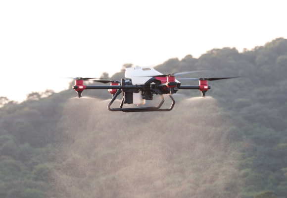
Spraying & spreading drone
Our agricultural application sector solutions include aerial spraying and aerial spreading. To protect the plants and increase crop yield, you will receive recommendations and advice from our knowledgeable agronomists regarding the treatments that are most suited for your farm and plants at the right
time of year.
High Accuracy
Spray or spread with centimetre level accuracy using Real Time Kinematic (RTK) positioning system.
AUTONOMOUS ON ALL-TERRAIN
Preload 3D landform, enhanced flight safety.
Regulate Droplet Size
Change droplet size from 40 micron to 400 micron with Intelligent Rotary Atomisation System (iRass).
20 Liter Payload
Cover bigger area and high productivity in one flight with 20 liter smart liquid tank.
GRANULAR SPREADING
Only this spreading drone can spread non- destructively after germination of rice seeds, and the throwing disc type will damage the seed and seriously affect the yield
Safe in the sky
Safer flight with 4D imaging radar and obstacle avoidance system.
BENEFIT OF DRONE SPRAYING & SPREADING

SOLUTION FOR LABOUR SHORTAGE
- Intelligent agricultural UAV is a permanent solution for all farmers who keen to sustain their farming activities with minimized labour.
- Our agricultural drones are being used for wide ranges of application from fertilizers, herbicides, pesticides, fungicides, seeds, and more.

Low cost, fast & high Accuracy
- Applying the right chemicals in the right quantity, in the right locations and at the right time to solve the constant challenge for farmers.
- Distribute chemicals accurately, evenly, and efficiently which leads to a reduction in the costs through manual labour while maintaining promising crop yields.

Precision agriculture
- Agricultural drones are powerful tools that allow farmers to speed up and automate manual processes.
- The agricultural drones can help farmers to work smarter, faster, and with greater precision than ever and enables vital aspects of precision farming to take place around the clock.
What Smart IOT Sensing Can Do?
SMART IOT SENSING
The smart sensing solutions provide farmers with the digital farm equipment to scout their field up to soil properties by providing accurate and smart data that farmers can use it to automate the framing process, forecast future expectations, optimize inputs, and react quickly to possible threats.

Soil sensor
Soil Moisture & Temperature
Accurately detect macronutrients for fertilizer application and planning.
Soil EC
Measure the soil electricity conductivity that affects health of crops.

FARM CAMERA
Real Time Data
Monitor 24/7 of full HD pictures or video.
Identify and record any intruders or animals entering your farm

WEATHER SENSOR
Temperature Sensor
Detect ambient condition for crop monitoring.
Humidity Sensor
Make better decisions about water usage and pending rain.
Rainfall Intensity Sensor
Monitor rain fall & optimizing the water usage.
Message us, we will be in touch shortly
For inquiries about our Precision Agricultural Technologies or to learn how Vision One UAS Sdn. Bhd. can support your agricultural needs, please get in touch with us. Our team is ready to assist you.
Follow our social media